
எது திராவிட தேசம்? What is Dravida Desa
1828 ஆம் ஆண்டு கால்டுவெல் பாதிரியாருக்கு நாலு வயசு இருந்தப்ப வெளிவந்த சாசனம் தான், Hamilton Walter எழுதிய The East India Gazetteer – கிழக்கிந்திய செய்தி விளக்கச் சுவடி” திராவிட நாடு என்பது பின்வரும் பகுதிகளை உடையது எனக் குறிப்பிடப்பட்டுள்ளது.
திராவிட நாடுகள் என்பன அன்றைய சேர நாடு, கன்னட நாட்டின் சில பகுதிகள், தமிழகத்தை உள்ளடக்கிய பழைய மதராஸ் மாகாணமான தமிழ் பேசிய சேர, சோழ, பாண்டிய நாடுகளைக் குறிக்கின்றது. இத்தகவலை குறித்தவர் கிழக்கிந்திய கம்பெனியின் பிரித்தானிய அறிஞரும்,நில அளவீட்டாளர்கள் Colebrooke and Francis Buchanan ஆவர்.
திராவிட தேசத்தின் கிழக்கு எல்லை கடல் என்றும், மேற்கு எல்லை கிழக்கு தொடர்ச்சி மலை என்றும். அதோடு மட்டும் அல்லாது எங்கெல்லாம் தமிழர்கள் பரவி இருந்தார்களோ அவையே திராவிட தேசம் என அழைக்கப்பட்டது என்று குறித்துள்ளனர். ஆங்கிலேயர் வருகைக்கு முன்பே தமிழர் வாழ்ந்த பகுதிகள் திராவிட தேசம் எனப்பட்டன. தெலுங்கல் வாழ்ந்த பகுதி தைலிங்கா எனப்பட்டது.
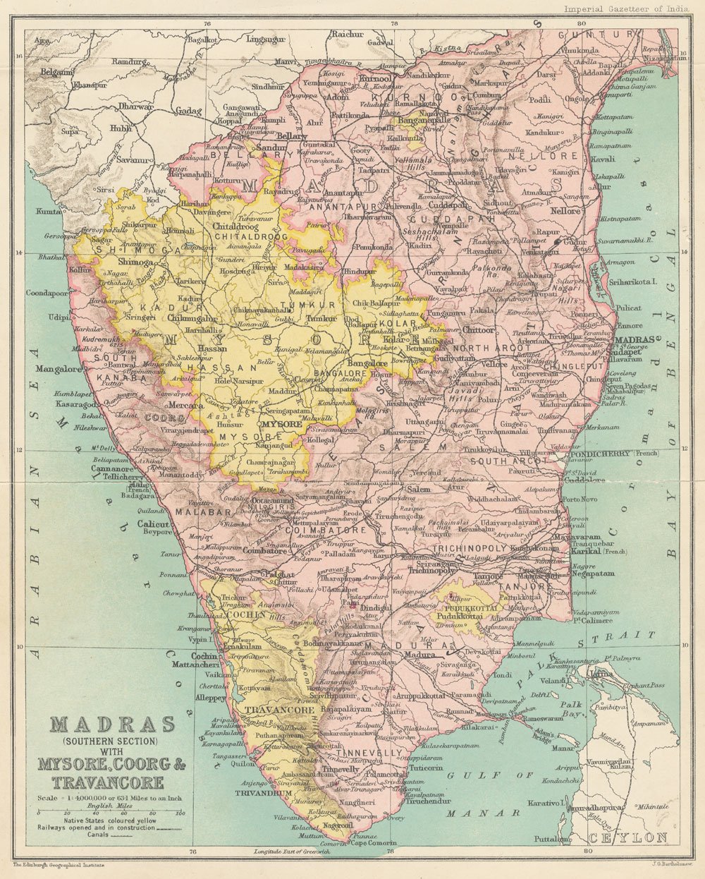
Dravida (or Dravira), the ancient name for the region that constitutes the southernmost part of India. It provides geographical boundaries and mentions the ruling dynasties and subdivisions of the region.
Geographical Boundaries of Dravida:
The northern boundary of Dravida is between the 12th and 13th degrees of north latitude. It is bordered by the sea on the east and by the Eastern Ghats on the west. This description roughly corresponds to modern Tamil Nadu and parts of Kerala and Karnataka.
Extended Usage of the Term:
While the term Dravida primarily referred to South India, it was sometimes used to denote all regions where the Tamil language was spoken. Additionally, a group of Brahmins was known as Dravida Brahmins, signifying their cultural and geographical association with this region.
Subdivisions of Dravida:
The region was historically divided based on three prominent ruling dynasties:
1. Chola Dynasty (Cholan) – Ruled over Tanjore (Thanjavur) and Kumbakonam (Combooconum), covering the northern parts of Dravida.
2. Pandya Dynasty (Pandian) – Controlled Madurai (Madura) and the southern part of the region.
3. Chera Dynasty (Cheran) – United Karur (Kamam) and Salem with the Kerala region, which was along the Malabar Coast.
Sources Mentioned:
The information comes from historical studies by Colebrooke and Francis Buchanan, both of whom were British scholars and surveyors who documented Indian history and geography.